
The insurance industry is increasingly adopting virtual inspections where satellite-derived evidence layers replace subjective ground reports to reduce adjustment costs and prioritize the most severe losses. As extreme weather events grow in both frequency and intensity, traditional risk assessment methods that rely primarily on historical ground-level data have begun to falter under the weight of modern volatility. By integrating sophisticated space-based analytics, insurers now leverage automated and highly accurate risk models that provide a granular, property-level view of vulnerabilities. This paradigm shift addresses the rising expectations of policyholders who demand faster service and more transparent outcomes during times of crisis. Beyond speed, these satellite tools offer companies a cost-effective alternative for remote damage assessment, allowing for long-term strategic planning that was previously impossible without significant manual labor and physical travel.
The Foundation: Integrating Multi-Dimensional Geospatial Data
At the core of this technological evolution lies the sophisticated processing of various satellite data formats that together create a comprehensive picture of environmental risk. Modern insurers utilize point data to pinpoint specific coordinates, while vector data helps define building footprints and complex administrative boundaries. Furthermore, raster data provides critical environmental indicators such as slope analysis and vegetation health, which are essential for predicting wildfire paths or landslide susceptibility. By merging these distinct layers through advanced spatial interpolation techniques, the industry can bridge the significant data gaps that manual ground-based surveys often overlook. This synthesis of data allows for the creation of a dynamic digital twin of the landscape, providing a context that static maps simply cannot offer. Consequently, firms can evaluate hazards with a level of precision that matches the actual physical environment rather than a generalized regional estimate.
The transition toward space-derived intelligence facilitates a precise, property-level risk score that fundamentally changes the nature of underwriting. Traditional models often grouped homes into broad categories, leading to unfair pricing for homeowners who had taken proactive mitigation steps. Now, by analyzing high-resolution imagery and historical weather patterns, insurers can identify specific structural features or proximity to hazards that influence a building’s resilience. This granular approach allows for the creation of highly tailored insurance products that reflect the unique risk profile of every individual asset. As these specialized data streams become more accessible, the industry has shifted away from generalized actuarial tables toward a more responsive, data-driven pricing structure. This ensures that premiums are accurately aligned with the actual risk, promoting fairness for consumers while protecting the financial stability of the insurer against unexpected claims surges.
Operational Resilience: Overcoming Environmental Obstacles via Multi-Sensor Arrays
One of the most significant challenges in disaster management is maintaining continuous visibility during active atmospheric events, such as the major 2026 Coimbra floods in Portugal. Standard monitoring methods, including drones and ground teams, often fail when heavy cloud cover or hazardous conditions prevent safe operations or obscure the view of the terrain. To solve this, a multi-sensor approach combines Synthetic Aperture Radar (SAR) with high-resolution optical imagery to maintain a steady stream of information regardless of the weather. SAR sensors are particularly valuable in these scenarios because they emit microwave pulses that can penetrate dense clouds, smoke, and heavy rain to map flood zones and ground changes in total darkness. Once the weather clears, high-resolution optical satellites provide the necessary visual context to identify specific structural failures and damaged public infrastructure. This combined capability ensures that decision-makers never operate in the dark.
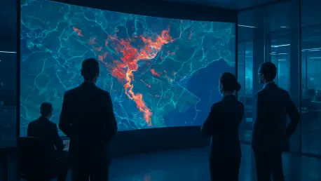
This multi-layered observation strategy relies on rigorous cross-validation to ensure the highest level of accuracy for emergency responders and insurance adjusters alike. Digital footprints captured from space are systematically triangulated with localized media reports and crowdsourced information to confirm that satellite findings align perfectly with the reality on the ground. By using specialized spectral indices to identify saturated soil and subtle structural shifts, analysts can produce a detailed, heat-mapped view of the affected area with remarkable speed. This objective, time-stamped evidence layer serves as a reliable foundation for both immediate rescue efforts and the subsequent complex financial recovery phase. The ability to verify claims remotely using these scientific datasets reduces the potential for fraud and human error, which often plagues disaster zones in the chaotic days following an event. It ultimately fosters a more reliable partnership between the public and private sectors.
Modern Recovery: Enhancing the Lifecycle Through Automated Workflows
The integration of satellite data into existing corporate workflows creates a scalable framework for managing live exposure during a crisis. As a disaster unfolds, all-weather radar sensors provide an immediate footprint of the impacted region, which can be fused with geocoded policy registries in real time. This automated synergy allowed insurers to instantly identify which customers were affected and estimate total financial exposure before the first claim was even filed. Beyond financial calculations, this real-time mapping proved critical for logistics, helping emergency teams prioritize their response to isolated communities that were cut off from traditional communication channels. By identifying road washouts and bridge collapses through change-detection algorithms, logistics coordinators could reroute supplies and medical aid with unprecedented efficiency. This proactive stance transformed the role of the insurer from a passive payer to an active partner in the immediate life-saving efforts within the community.
In the aftermath of the most recent catastrophic events, the industry successfully shifted its focus to damage verification and the significant acceleration of the claims process. High-resolution imagery allowed for a nuanced classification of damage, distinguishing between minor roof issues and total structural losses with high confidence. This enabled a system of virtual inspections where hard evidence from space replaced the need for risky and time-consuming ground visits. Furthermore, these measurements acted as parametric triggers, automatically issuing payouts when specific thresholds, such as flood depth or wind speed, were scientifically met. By using this objective data to refine their catastrophe models, insurers improved their future pricing strategies and made more informed decisions regarding reinsurance coverage. These technological advancements provided a clear pathway for more resilient urban planning and prioritized the rapid financial stabilization of displaced families, ensuring that the recovery process was more equitable.