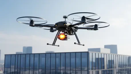

The traditional image of an insurance adjuster teetering on a precarious ladder to inspect storm-damaged roofs is rapidly fading into obsolescence as the global insurance industry embraces high-precision aerial robotics. This transition marks a fundamental shift in how the sector perceives risk and manages liabilities, moving away from subjective human observation toward data-driven, objective analysis. As of 2026, the proliferation of Unmanned Aerial Vehicles (UAVs) has moved beyond an experimental novelty to become a core operational necessity for carriers seeking to maintain a competitive edge in an increasingly tightening market. By integrating these advanced platforms, insurance firms are bridging the gap between physical reality and digital modeling, allowing for a level of transparency and speed that was previously unimaginable. This evolution is not merely about replacing human labor with machines; it represents a comprehensive overhaul of the underwriting and claims lifecycle, ensuring that every assessment is backed by high-resolution imagery and complex metadata. The impact of this shift is visible in the streamlining of bureaucratic hurdles and the significant reduction in settlement turnaround times, which ultimately benefits the policyholder while stabilizing the carrier’s bottom line in an era of environmental volatility.
Historically, the insurance sector relied heavily on time-consuming on-site visits that carried inherent safety risks for personnel and often resulted in inconsistent data collection due to the limitations of manual inspection. However, the current landscape of 2026 reveals that drones have emerged as the cornerstone of modern “InsurTech,” offering a faster and more accurate alternative for evaluating risk and settling claims with unprecedented efficiency. The core value proposition of this technology lies in its ability to utilize high-resolution cameras, thermal sensors, and advanced Artificial Intelligence to detect anomalies that are invisible to the naked eye. By adopting these tools, insurance companies can now perform detailed assessments of high-rise commercial structures or expansive agricultural tracts that were previously considered impossible or too expensive to execute. This technological leap has paved the way for a more resilient industry capable of responding to catastrophic events with the speed required by modern society. As these systems become more autonomous and integrated with existing enterprise resource planning software, the reliance on traditional methods will continue to dwindle, replaced by a sophisticated digital ecosystem that prioritizes accuracy and safety above all else.
Market Valuation: From Initial Adoption to Global Dominance
The financial trajectory of the drone market within the insurance sector provides a clear indicator of the industry’s commitment to digital transformation and automated workflows. In 2025, the global market for drones in the insurance sector reached an initial valuation of $1.49 billion, a figure that reflected the culmination of early adoption phases where major carriers successfully tested the feasibility of aerial imaging for routine property checks. This baseline established the necessary infrastructure and confidence for smaller players to enter the space, creating a ripple effect across the global economy. As we move through 2026, the market is expected to climb significantly to $2.27 billion as medium-sized insurers begin to adopt drone-based workflows as a standard operating procedure. This surge highlights the industry’s rapid acceleration in technology procurement and the deep integration of aerial data into core business models, transforming how assets are valued and how risks are mitigated across the board.
Looking further ahead, the market is projected to reach a substantial $3.47 billion by 2035, signaling a shift from rapid expansion to a period of market maturity and optimization. This trajectory suggests that drone technology will transition from being a competitive advantage to a standard industry requirement, much like the adoption of mobile computing or cloud storage in previous decades. The forecasted Compound Annual Growth Rate (CAGR) of 52.62% stands as one of the highest in the technology sector, driven by a systemic need for operational efficiency and data accuracy. This staggering growth is underpinned by the fact that over 60% of digital insurance projects now incorporate some form of remote inspection or aerial surveillance tool. This investment is not just about the hardware itself but about the long-term value of the data generated, which feeds into advanced actuarial models and helps companies better understand the evolving nature of risk in a world characterized by changing climate patterns and urban density.
The sustained investment in these technologies is also a response to the increasing complexity of modern infrastructure and the need for more granular data. As property designs become more intricate and high-density urban environments continue to expand, traditional ground-based inspections are becoming less effective and more dangerous. The valuation of the market reflects the industry’s willingness to pay for solutions that solve these specific pain points, ensuring that the valuation of $3.47 billion by 2035 is not just a theoretical peak but a reflection of the technology’s utility. Carriers are increasingly seeing drones as a defensive investment against claims leakage and fraudulent activities, which cost the industry billions annually. By creating a transparent, unalterable digital record of property conditions, drones provide a level of security that traditional methods simply cannot match, justifying the aggressive growth projections and the continued capital allocation toward aerial robotics.
Technological Breakdown: Hardware, Software, and Specialized Services
The architecture of the insurance drone market is built upon three primary pillars that work in tandem to deliver actionable insights to adjusters and underwriters. The hardware segment currently holds the largest share of the market, valued at approximately $0.83 billion as of 2025, encompassing the physical UAVs, specialized infrared sensors, and high-bandwidth communication modules. These physical platforms must be rugged enough to withstand diverse environmental conditions, from the humid corridors of tropical regions to the high winds associated with coastal storm fronts. Modern hardware is increasingly defined by its modularity, allowing insurers to swap out standard RGB cameras for thermal imaging units or LiDAR sensors depending on the specific requirements of the inspection. This versatility ensures that a single fleet of drones can serve multiple departments within an organization, from assessing roof damage on residential homes to monitoring structural integrity on industrial cooling towers or large-scale energy projects.
While hardware provides the physical means of data collection, software represents the essential “brain” of drone operations and is currently the fastest-growing segment with a CAGR of 54.20%. These software solutions include AI-driven image analysis and complex 3D mapping algorithms that allow adjusters to convert thousands of individual aerial photos into a single, cohesive, and accurate damage report within minutes. This automation is critical for managing the massive influx of data generated during high-demand periods, such as the aftermath of a major hurricane or wildfire. By using machine learning to automatically flag missing shingles, cracked tiles, or thermal leaks, the software reduces the cognitive load on human adjusters and ensures that no detail is overlooked. This level of processing power is what enables the high-speed settlement of claims, turning raw visual data into financial decisions that can be communicated to policyholders in real-time.
Complementing the technical components is the services segment, which covers “Drone-as-a-Service” (DaaS) and specialized pilot training programs essential for companies looking to avoid the massive overhead of fleet maintenance. This area is growing steadily as smaller and mid-sized insurers choose to outsource their aerial needs to specialized third-party firms that provide both the equipment and the certified operators. Furthermore, specialized components such as thermal imaging and high-resolution RGB cameras are becoming increasingly sophisticated and affordable, allowing for more widespread deployment. These hardware improvements are essential for meeting the growing demand for drones with longer battery lives and the ability to operate safely in complex urban landscapes where GPS signals may be obstructed by skyscrapers. As the ecosystem matures, the distinction between these three segments is becoming blurred, with more companies offering integrated end-to-end solutions that combine hardware, software, and operational support into a single, seamless package.
Strategic Application: Claims Processing and Risk Assessment
Claims processing remains the most mature and impactful application for drones in the current market, accounting for approximately 35% of the total market share. By deploying drones to disaster zones or damaged roofs immediately following an event, insurers can reduce the time it takes to settle a claim from several weeks to just a few days. This speed is particularly vital in the context of natural disasters where policyholders need immediate financial relief to begin the recovery process. Drones can access areas that are physically blocked by debris or otherwise hazardous for human adjusters, providing a clear bird’s-eye view of the destruction without putting lives at risk. The objective nature of the imagery also helps to mitigate disputes between the insurer and the insured, as high-resolution evidence provides a factual basis for the payout, significantly reducing the likelihood of costly litigation or prolonged negotiations.
Beyond the immediate aftermath of a loss, underwriters are increasingly utilizing drones for detailed risk assessments before a policy is even written. By identifying pre-existing issues such as roof degradation, poor drainage patterns, or nearby environmental hazards, insurers can price their policies with much higher precision than traditional methods allow. This proactive approach to risk management helps to ensure that premiums are fair and reflective of the actual condition of the asset, rather than relying on outdated records or subjective assessments. Property appraisal for both residential and commercial real estate benefits significantly from the 3D modeling capabilities of modern UAVs, providing a complete and objective view of a property’s condition. This technology allows for a level of detail that covers every square inch of a structure, including hard-to-reach areas like chimneys, gutters, and HVAC systems, ensuring that the valuation is based on the most current and accurate data available.
Niche applications are also expanding into areas such as agricultural crop insurance and large-scale environmental monitoring, where the scale of the task makes manual inspection virtually impossible. In the agricultural sector, drones can survey thousands of acres of storm-damaged or pest-infested crops in a fraction of the time required by a human surveyor on the ground. These drones use multispectral sensors to detect plant health and moisture levels, allowing insurers to accurately estimate yield losses and provide fair compensation to farmers. Similarly, in the event of environmental accidents, drones can be used to monitor the spread of pollutants or assess damage to protected ecosystems, providing a vital service for specialized liability insurance. As these niche applications continue to prove their worth, they are likely to account for a larger portion of the market, further diversifying the utility of aerial robotics within the broader insurance landscape.
Regional Dynamics: Dominance and Rapid Growth Hubs
North America currently leads the global market with a significant 38% share, a position driven by a highly sophisticated insurance sector and the frequent occurrence of weather-related claims such as hail, tornadoes, and wildfires. In the United States, nearly 65% of large-scale insurers have already scaled their drone operations to handle the massive volume of property inspections required annually. The regulatory environment in North America has also become increasingly supportive of commercial drone operations, with clear guidelines for pilot certification and flight permissions. This established infrastructure has allowed for a more rapid integration of drones into the daily workflows of adjusters, making it the most advanced region in terms of operational maturity. The presence of major tech hubs and a robust venture capital ecosystem has also fostered the growth of numerous startups focused specifically on insurance-related drone software and services.
The European market, while growing, is defined by its strict data privacy standards and evolving aviation regulations that vary between member states. Digital transformation among established carriers in the United Kingdom, Germany, and France is pushing the region toward a significant valuation in the coming years as companies adapt to the harmonized European Union Aviation Safety Agency (EASA) rules. European insurers are particularly focused on using drones for the inspection of historic buildings and complex urban infrastructure, where traditional scaffolding and manual labor are both expensive and intrusive. The emphasis on data security means that software providers in this region must implement the highest levels of encryption and data handling protocols, creating a specialized market for privacy-compliant aerial analytics. As these regulatory hurdles are cleared, Europe is expected to see a surge in adoption, particularly among specialized commercial and industrial insurers.
Asia-Pacific stands out as the fastest-growing region in the world, fueled by rapid urbanization in major economies like China and India and a massive agricultural insurance sector. The region’s interest in technological modernization and its role as a manufacturing hub for drone hardware contribute to a high regional growth rate that is expected to challenge North American dominance in the next decade. In China, the integration of drones with mobile payment and digital claim platforms has created a highly efficient ecosystem that caters to both urban and rural populations. Meanwhile, in the Middle East and Africa, drone usage is primarily focused on infrastructure and large-scale energy projects, such as oil refineries and solar farms. Growth in this region is supported by the development of “smart cities” and high-budget industrial insurance requirements that demand the most advanced monitoring technologies available. These diverse regional drivers ensure that the growth of the insurance drone market is a truly global phenomenon, with each area contributing unique innovations and use cases.
Operational Excellence: Accuracy, Speed, and Personnel Protection
The integration of Artificial Intelligence with drone technology has fundamentally improved damage detection accuracy, with recent studies indicating a 70% improvement compared to ground-based human inspections. This precision is critical for insurers looking to reduce “leakage,” a term referring to the unintentional overpayment or underpayment of claims due to human error or incomplete data. When a drone captures an image, the AI can cross-reference it with thousands of other data points to identify specific types of damage, such as the distinct pattern of hail impact on a shingle or the subtle discoloration that indicates a moisture leak. This level of consistency ensures that every policyholder receives a fair and accurate settlement, while the insurer protects its capital from unnecessary expenditures. This shift toward automated accuracy is also reducing the need for multiple follow-up visits, as the initial drone flight often captures all the necessary data in a single pass.
Beyond accuracy, drone-supported assessments can reduce manual fieldwork by 50% and shorten the total inspection time by an average of 60%. This efficiency allows a single adjuster to process significantly more claims per day, which is especially important during “catastrophe season” when thousands of claims may be filed simultaneously. By lowering the operational cost per claim by nearly 40%, insurance companies can reallocate their human resources to more complex tasks that require empathy and nuanced judgment, such as customer service and complex fraud investigations. The ability to process claims faster also improves customer satisfaction scores, as policyholders are no longer left waiting for weeks to receive the funds they need to repair their homes or businesses. This operational speed is becoming a major differentiator in an industry where customer experience is increasingly tied to digital proficiency and responsiveness.
Worker safety serves as another primary driver for the adoption of drones, as these aerial systems eliminate the need for adjusters to climb onto steep, high, or unstable roofs. By keeping “boots on the ground,” insurance companies significantly reduce their workers’ compensation risks and improve their overall safety records, which can lead to lower internal insurance costs for the firms themselves. This is particularly relevant in the wake of natural disasters, where buildings may be structurally compromised or surrounded by hazardous conditions like downed power lines and floodwaters. Drones provide immediate access to these areas, allowing for a thorough assessment without exposing personnel to physical danger. Currently, roughly 40% of all drone applications in the sector are linked to catastrophe response, highlighting the critical role that technology plays in maintaining safety and providing rapid financial relief during the most challenging times.
Overcoming Obstacles: Regulation, Privacy, and Technical Integration
Despite the clear benefits, aviation authorities maintain strict rules regarding “Beyond Visual Line of Sight” (BVLOS) flights, which remains a significant operational hurdle for many insurance operators. Navigating these flight permissions and ensuring that all pilots are properly certified is a complex and time-consuming task for nearly half of commercial operators in the space. While regulatory bodies are working to streamline these processes, the current requirement for a pilot to maintain a direct line of sight with the drone limits the efficiency of inspections over large areas or in dense urban corridors. This necessitates a high level of logistical planning and often requires the presence of multiple personnel on-site, which can offset some of the cost savings associated with the technology. However, as “detect and avoid” technologies become more sophisticated, it is expected that BVLOS permissions will become more common, unlocking the full potential of autonomous aerial fleets.
Capturing high-resolution images of private property also raises significant concerns regarding data privacy and the security of the information collected. Insurers must implement robust encryption and strict data handling protocols to ensure that sensitive visual data is protected from cyber threats and unauthorized access. There is a delicate balance between collecting the data necessary for a claim and respecting the privacy of the policyholder and their neighbors. This has led to the development of sophisticated software that can automatically blur out faces, license plates, and other non-relevant features in the background of an inspection photo. Furthermore, there is a notable shortage of professionals who possess the dual skills of drone piloting and insurance adjusting, creating a talent gap that many companies are struggling to fill. Integrating drone data into older, legacy software systems also remains a significant technical barrier for many organizations, requiring substantial investment in IT infrastructure to ensure a smooth flow of information.
Environmental factors, such as high winds, heavy rain, and extreme temperatures, can also ground drone operations and delay critical inspections during peak demand periods. Approximately 30% of scheduled flights are currently affected by adverse weather conditions, which can be particularly problematic during the high-demand periods following a major storm. While drone manufacturers are working to develop more weather-resistant platforms, there are physical limits to what a small UAV can handle in extreme conditions. This means that insurers must still maintain a level of traditional inspection capability as a backup, leading to a hybrid model of operation. Additionally, the rapid pace of technological change means that hardware can become obsolete quickly, requiring companies to continuously update their fleets and software subscriptions to stay current. Managing these technical and regulatory challenges requires a dedicated strategy and a willingness to invest in long-term solutions rather than quick fixes.
Market Leadership: Competitive Trends and Industry Innovators
DJI remains the global leader in hardware, providing the industry-standard platforms used for the majority of roof inspections and thermal imaging tasks across the commercial sector. Their technology is widely adopted for its reliability, ease of use, and the high quality of its integrated sensors, making it the go-to choice for both large carriers and independent adjusters. However, the market is seeing increased competition from companies that focus on specialized, high-security platforms designed for the specific needs of Western markets. Software innovators like DroneDeploy provide the essential cloud-based infrastructure necessary for managing the massive amounts of data generated during aerial surveys. Their platforms allow insurers to automate the creation of 3D maps and detailed damage reports, streamlining the entire reporting process from the initial flight to the final claim payout. This focus on automation and user-friendliness is what allows non-technical adjusters to utilize advanced aerial data in their daily work.
Specialized providers like Kespry and Parrot are also focusing on delivering end-to-end solutions that are tailored specifically for the unique requirements of the insurance industry. These companies emphasize automated hail damage detection and large-scale mapping for commercial properties, providing a level of specialization that generic drone platforms often lack. By focusing on “vertical” integration, these firms can offer a more seamless experience for the user, with hardware and software that are perfectly calibrated to work together. This competitive landscape is driving rapid innovation, as companies vie to offer the most accurate AI models and the most durable hardware. We are also seeing a trend toward partnerships between drone companies and traditional insurance software providers, ensuring that aerial data can be easily integrated into existing claims management systems without the need for manual data entry or complex file transfers.
The competitive landscape is also being shaped by the rise of specialized service providers that offer “on-demand” drone inspections. These companies maintain a network of certified pilots who can be dispatched to a location within hours, allowing insurers to scale their operations up or down depending on the current claim volume. This model is particularly attractive for smaller insurance companies that may not have the budget to maintain an in-house drone program but still want to offer their customers the benefits of high-speed aerial inspections. As the market continues to evolve, the focus is shifting away from just the “cool factor” of flying drones toward the tangible business value they provide in terms of data accuracy and operational savings. This maturity is reflected in the way companies are now marketing their services, with a heavy emphasis on ROI, safety compliance, and the seamless integration of data into the broader insurance ecosystem.
Strategic Foresight: Autonomous Systems and Predictive Modeling
The industry is rapidly moving toward the use of fully autonomous “drone-in-a-box” systems that can be permanently stationed on the roofs of high-value commercial buildings or in disaster-prone areas. These units are designed to launch automatically after a sensor detects a storm event or a structural anomaly, perform a pre-programmed survey of the property, and then return to their base to recharge and upload the collected data without any human intervention. This level of automation represents the next frontier in insurance technology, allowing for near-instantaneous damage assessment and risk monitoring. By having a persistent aerial presence, insurers can provide a higher level of service to their commercial clients, offering real-time insights into the health and safety of their assets. This proactive approach not only speeds up the claims process but also helps to prevent small issues from escalating into major losses by providing early warning signs of structural failure.
Predictive risk modeling is another emerging trend that will allow insurers to move from simply reacting to damage to predicting structural failures before they even occur. By identifying small weaknesses early, such as a loose shingle or a clogged drainage system, insurers can encourage preventive maintenance and potentially avoid massive future claims altogether. This shift toward “preventative insurance” is made possible by the continuous collection of high-resolution data over the life of a policy, allowing for a much more nuanced understanding of how properties age and respond to environmental stressors. As AI models become more sophisticated, they will be able to predict the likelihood of a failure based on a combination of aerial imagery, weather patterns, and historical data. This will lead to a fundamental change in the relationship between the insurer and the insured, moving from a purely financial arrangement to a partnership focused on asset protection and longevity.
The eventual integration of drones with the broader Internet of Things (IoT) will create a holistic digital security and monitoring ecosystem that covers every aspect of a property’s risk profile. This connectivity will allow drones to work in tandem with indoor smart sensors, security cameras, and environmental monitors to provide a complete, 360-degree view of property safety and insurance risk. For example, an indoor leak sensor could trigger an outdoor drone flight to inspect the roof for the source of the water entry, providing a comprehensive report to the adjuster before they even arrive on-site. This level of integration will require a high degree of standardization across different technology platforms, but the benefits in terms of risk mitigation and operational efficiency are too significant to ignore. As these technologies converge, the insurance drone market will become an inseparable part of the broader move toward smart, resilient, and data-driven urban environments.
The transformation of the global insurance drone market has already demonstrated how technological integration can fundamentally reshape a traditional industry through enhanced precision and operational speed. Organizations that invested in these aerial systems early successfully reduced their inspection costs and improved the accuracy of their risk assessments across diverse property portfolios. Moving forward, stakeholders should focus on the seamless integration of AI-driven analytics with existing legacy systems to ensure that data flows are not siloed within specific departments. Investing in the continuous training of personnel to handle both the technical and ethical aspects of drone data will be crucial for maintaining public trust and regulatory compliance. As the industry looked toward the maturation of the market, the emphasis shifted from mere data collection to the development of actionable, predictive insights that prevented losses before they occurred. By prioritizing these strategic next steps, carriers ensured they remained resilient in a future where data-driven decision-making became the baseline for survival in the global insurance landscape.