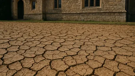

Beneath the manicured lawns and historic facades of Britain’s most sought-after postcodes, a volatile geological shift is rewriting the financial rules of homeownership. For generations, the British home was considered the ultimate stable asset, but the convergence of extreme weather and shifting soil has introduced a level of unpredictability that the insurance industry is only beginning to quantify. The year 2025 served as a stark awakening for the market, highlighting how quickly environmental changes can translate into billions of pounds in structural damage and liability.
The High Cost of a Changing Landscape
The economic impact of this environmental transition became undeniable when the total bill for property claims reached a historic £6.1 billion. This staggering figure was fueled by a record-breaking subsidence payout of £307 million, the highest ever recorded for the domestic sector. The primary catalyst was a “Perfect Storm” where an exceptionally dry spring dehydrated the ground, followed by intense precipitation that caused the soil to heave. This cycle of extreme contraction and expansion put unprecedented stress on older foundations, turning manageable maintenance into a national financial crisis.
Within the insurance sector, a strange paradox emerged as the severity of these events intensified. While the costs for flood and subsidence claims skyrocketed, average policy prices for combined buildings and contents insurance actually saw a minor decrease toward the end of 2025. This suggests that while the industry was paying out record sums, the market remained highly competitive, and premiums had not yet fully adjusted to the emerging reality of climate risk. However, as the frequency of these “once-in-a-generation” weather events increases, the gap between policy pricing and actual risk is expected to close rapidly.
Mapping the Environmental Crisis: Data and Realities
The primary drivers of this crisis are no longer confined to the traditional floodplains of the North or the rugged cliffs of the West. Shrink-swell subsidence, surface water volatility, and the terminal threat of coastal erosion are now the dominant forces shaping property risk. These geological hazards are transforming once-stable neighborhoods into high-risk zones, often with very little warning for the residents. The shift in meteorological patterns means that areas with heavy clay deposits or poor natural drainage are seeing a rise in structural issues that were non-existent a decade ago.
A fundamental change is occurring in how the industry views these environmental threats. What was once classified as an “unforeseen accident” is now being re-evaluated as a “scheduled certainty.” Advanced modeling allows analysts to see exactly how specific soil types will react to projected temperature increases and rainfall intensity. As a result, property risk assessment is moving away from probability and toward a predictable timeline of structural decay. This makes it increasingly difficult for homeowners in certain regions to argue that damage is accidental rather than an inevitable consequence of the local environment.
A Closer Look at the Three Primary Perils
The “subsidence squeeze” is most acutely felt in London and the South East, where the mechanics of clay soil dominate the landscape. In boroughs such as Camden and Islington, as well as parts of Kent, the contraction of the earth during dry spells has reached critical levels. Recent warnings from the British Geological Survey suggest a sobering future: by 2070, up to 50% of London properties could face a high or extreme risk of subsidence. This is not a distant concern, as the average household claim for soil-related damage has already hit a record £20,000, reflecting the high cost of stabilizing shifting foundations.
Flooding has also evolved into a new, more erratic threat that extends far beyond traditional riverbanks. Surface water flooding, caused by intense and localized summer downpours, has become the most widespread threat to UK homes. These deluges overwhelm urban drainage systems regardless of how far a house is from a river or the sea. The Environment Agency now projects that by 2050, as many as 8 million properties could be at risk from some form of flooding. This expansion of risk zones means that properties previously considered “safe” are now being caught in the crosshairs of a more violent water cycle.
Coastal erosion represents the most final of these perils, where property loss is not just a matter of repair but of permanent disappearance. The Holderness Coast and parts of North Norfolk serve as grim case studies in rapid land loss, where the sea is reclaiming meters of cliff edge every year. In villages like Happisburgh, the policy has shifted from active protection to “active demolition,” where houses are taken down before they can collapse into the surf. For these coastal assets, the scenario is one of total loss, where the property ceases to be an insurable risk and becomes an inevitable casualty of geography.
Expert Insights and Geological Granularity
The emergence of postcode-level data has revolutionized the way underwriters analyze risk. By using British Geological Survey modeling, insurers can now look at the specific geology of a single plot and even account for the type of tree cover nearby. Trees, while beneficial for the environment, can accelerate subsidence by pulling moisture from clay soil during heatwaves. This level of granularity allows for a sharp differentiation in risk between two houses on the same street, making the insurance market more precise but also more punishing for those in the “wrong” spot.
Experts are increasingly moving away from traditional metrics, such as simple distance from a river, to more complex assessments of soil moisture and drainage capacity. This high level of predictability creates a challenge for the traditional insurance model. If a computer model can predict with 90% certainty that a house will have a foundation failure within the next ten years, the damage loses the element of chance required for standard coverage. The industry is grappling with how to cover properties that are essentially on a countdown toward a structural event.
Practical Strategies for Navigating the New Property Reality
The most successful homeowners of the past year were those who prioritized rigorous due diligence before finalizing a purchase. By utilizing the latest British Geological Survey and Environment Agency maps, buyers identified site-specific risks that standard local authority searches often overlooked. Investors focused on checking foundation depths in clay-heavy regions and analyzed the drainage capacity of a neighborhood before committing to a contract. These proactive measures allowed many to avoid assets that were destined for high premiums or structural instability as the weather patterns became more extreme.
Property owners who maintained their assets effectively adopted mitigation frameworks that stabilized their local environment. They managed vegetation strategically, ensuring that moisture-hungry trees were kept at a safe distance from foundations while implementing smart drainage solutions to handle sudden surface water. When it came to the insurance landscape, proactive communication with brokers proved essential. By presenting granular data on their property’s maintenance and resilience upgrades, owners secured fairer premiums even in high-risk postcodes. These actions ensured that the property market remained functional, as stakeholders looked toward a future where informed adaptation became the only viable path for protecting the nation’s housing stock.