
Global insurance markets are facing an unprecedented set of challenges as the frequency of catastrophic weather events makes traditional historical actuarial tables increasingly obsolete for modern risk prediction. This shift occurs in an era characterized by a complex polycrisis, where environmental, technological, and geopolitical instabilities converge to create high-stakes volatility for property and casualty providers. Relying on what happened ten years ago no longer provides an accurate roadmap for what will occur tomorrow, especially as climate-driven disasters like massive floods and sprawling wildfires become the new norm rather than rare outliers. Consequently, many high-risk regions are experiencing a surge in premiums or a total withdrawal of coverage by major firms, leaving a significant portion of the population vulnerable. The integration of high-resolution satellite imagery and advanced artificial intelligence offers a pathway toward stabilizing these markets by replacing guesswork with precision and enabling a more resilient financial framework for the global economy.
Bridging the Protection Gap with Real-Time Data
The Transition: From Historical to Predictive Models
The fundamental architecture of the insurance industry is undergoing a radical transformation from a reactive model to a proactive, predictive one. Historically, underwriters spent months analyzing decades of paper records and localized reports to determine the likelihood of a loss event, a method that is failing in the face of rapid ecological changes. By 2026, the adoption of machine learning models trained on multispectral satellite data has allowed firms to analyze ground conditions with a level of granularity that was previously impossible. These AI systems can detect subtle changes in vegetation health, soil moisture levels, and urban sprawl that signal an impending increase in fire or flood risk. This constant stream of data ensures that risk profiles are updated in real time rather than once every few years, allowing for more accurate pricing that reflects the actual current environment. This evolution helps prevent the sudden market exits that leave communities without options for property protection.
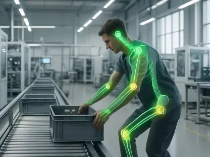
Building on this data-rich foundation, insurers are now utilizing artificial intelligence to create digital twins of entire geographic regions to simulate various disaster scenarios. This approach allows companies to stress-test their portfolios against specific vulnerabilities, such as a localized breach in a levee system or the rapid spread of a brush fire through a specific canyon. By moving away from broad generalizations about a zip code and focusing on the specific characteristics of an individual property, insurers can offer more personalized terms. For instance, a homeowner who has invested in fire-resistant landscaping or modern drainage systems can be rewarded with lower premiums, as satellite verification confirms these improvements. This dynamic relationship between the insurer and the insured creates a feedback loop where data-driven insights lead to better risk management and more sustainable insurance products for everyone involved.
Proactive Mitigation: Strategies for Property Owners
The “prevention is better than cure” philosophy is becoming the cornerstone of modern insurance, driven by the ability to monitor physical threats as they develop across the globe. Satellite constellations now provide daily imagery that allows insurers to identify specific hazards, such as an accumulation of dry fuel near a commercial facility or a blocked drainage canal before a major storm hits. Instead of waiting for a claim to be filed, insurance providers can issue automated alerts to policyholders, providing them with actionable advice to protect their assets. This shift from a purely financial entity to a risk-mitigation partner changes the value proposition for the customer. It moves the industry away from the simple reimbursement of losses and toward the active preservation of property and life. In this context, the integration of technology serves as an early warning system that reduces the overall severity of claims.
This proactive stance naturally leads to significant cost efficiencies for both the provider and the client by minimizing the scale of damage before it escalates. When an insurer can identify a potential threat in real time, the subsequent intervention often costs a fraction of what a total loss payout would require. For industrial sectors, this might mean moving high-value inventory before a predicted flood or deploying temporary defenses at a construction site. These strategic maneuvers are guided by AI algorithms that analyze satellite-derived weather patterns and terrain data to predict where the impact will be most severe. As these systems become more sophisticated between 2026 and 2028, the industry expects to see a marked decrease in the frequency of catastrophic losses. This trend not only preserves the capital of insurance firms but also ensures that critical infrastructure remains operational during and after significant environmental events.
Streamlining Recovery through Automated Damage Assessment
Verification: Accelerating Claims with Satellite-Enabled Verification
When a disaster strikes, the speed of the recovery process is often dictated by how quickly an insurer can verify the extent of the damage and release necessary funds. Traditionally, this involved deploying an army of human adjusters to physically inspect every site, a process that can take weeks or even months when infrastructure is damaged and access is limited. Today, however, high-resolution satellite imagery with sub-meter precision allows for wide-angle damage assessments to be conducted remotely within hours of an event. Artificial intelligence models can automatically compare “before” and “after” images to identify structural failures, roof damage, or total washouts. This automation removes the bottleneck of physical inspections for the most obvious cases, allowing human experts to focus their attention on complex claims that require a more nuanced touch. The result is a drastically shortened timeline for the initial payout process.
Beyond the speed of assessment, the use of objective geospatial data significantly reduces the friction and potential for disputes during the claims settlement phase. By having a clear, time-stamped visual record of the property’s condition immediately following a disaster, insurers and policyholders can work from a single source of truth. This transparency builds trust and ensures that homeowners and business owners receive the compensation they are entitled to without unnecessary bureaucratic delays. For communities trying to rebuild, this rapid infusion of capital is vital for restoring local economies and preventing a long-term decline in property values. The technology effectively acts as a bridge between the moment of crisis and the start of the recovery, ensuring that the financial support arrives when it is most needed. This efficiency is particularly crucial for small businesses that may not have the cash reserves to survive a prolonged wait for insurance checks.
Resilience: Global Economic Resilience and the Future of Coverage
The synthesis of satellite data and artificial intelligence is ultimately fostering a more resilient global economy by making insurance more accessible in previously uninsurable regions. By accurately quantifying risks that were once considered too volatile or unknown, insurers are finding the confidence to enter markets they had previously abandoned. This expansion of coverage is essential for maintaining the stability of the housing market and encouraging investment in emerging economies that are particularly susceptible to climate fluctuations. As high-quality data becomes more ubiquitous, the industry is moving toward a model where risk is shared more intelligently across the globe. This approach prevents localized disasters from bankrupting regional providers and ensures that the protection gap begins to close. The ability to visualize and analyze risk at scale provides a level of certainty that was unimaginable just a few years ago.
The evolution of these technological tools has dictated that the insurance sector must prioritize the continuous integration of geospatial intelligence into its core operations. Decision-makers recognized that investing in proprietary AI models and securing long-term satellite data partnerships provided a competitive advantage in an increasingly unstable world. It was recommended that firms establish cross-functional teams to translate satellite insights into localized policy adjustments to ensure relevance across diverse markets. Moving forward, the focus shifted toward expanding these capabilities to include real-time monitoring of supply chain disruptions and infrastructure vulnerabilities. By embracing a data-centric philosophy, the industry took the necessary steps to transition from a reactive financial safety net to a proactive architect of global stability. This transformation ensured that even as environmental challenges intensified, the mechanisms for economic recovery remained robust and responsive to the needs of the modern world.