
As technological advancements continue to redefine various sectors, agricultural insurance is witnessing unprecedented transformation through the integration of satellite data. This shift is not only enhancing efficiency and transparency but also addressing one of the most pervasive challenges in agricultural insurance: the protracted and complex insurance claim process. Traditionally, the verification and settlement of claims in this sector have been plagued by inefficiencies, leading to financial uncertainty and distress among farmers. Satellite data is emerging as a potent tool to simplify these processes, providing insurers with real-time insights that expedite claims and reduce the scope for errors and disputes.
Challenges in Traditional Agricultural Insurance
For decades, agricultural insurance claim processes have been slow and laborious, primarily due to the need for manual inspections across vast areas. The inherent variability in factors influencing farmland, such as microclimates and diverse soil compositions, further complicates the evaluation of losses. This not only delays the settlement of claims but also poses a significant risk of inaccuracies and fraudulent claims. In a world increasingly affected by climate volatility, traditional methods fall short in providing timely responses to farmers’ needs.
One of the most significant hurdles in traditional insurance is the time-consuming nature of physical inspections. Each claim requires detailed on-ground assessments, often leading to delays in verification. Factors such as workforce limitations, remote farm locations, and adverse weather conditions exacerbate these challenges. Furthermore, the manual process is prone to human error, introducing inconsistencies that can lead to disputes between insurers and farmers. This inefficiency not only affects the stakeholders directly involved but also hinders the ability to manage risks effectively at a broader level.
The reliance on antiquated systems also means that insurers face challenges in forecasting and pricing risk accurately. The fast-changing climate conditions and unpredictable agricultural environments demand a more dynamic and responsive approach. Current methodologies struggle to incorporate the latest environmental changes into predictive models, often resulting in premiums that don’t accurately reflect the associated risks, thus undermining the potential of agricultural insurance to serve as a robust financial safety net for farmers.
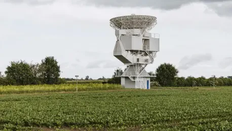
Advancements in Satellite Monitoring Technology
The introduction of satellite monitoring offers an objective and comprehensive means to assess crop health and the impact of adverse weather events, fundamentally changing how claims are processed. Modern satellites, equipped with multispectral and hyperspectral imaging technologies, provide accurate, high-resolution data that surpass the capabilities of traditional methods. By offering a bird’s-eye view of extensive agricultural landscapes, satellites facilitate a more precise understanding of field conditions, thus allowing for efficient and equitable handling of insurance claims.
These technological advancements are complemented by the integration of artificial intelligence in data analysis. Machine learning algorithms can analyze satellite images to detect anomalies, verify claims, and automate the processing, which drastically minimizes human intervention. This automated approach not only accelerates the claim settlement process but also reduces overhead costs for insurance companies, allowing them to allocate resources more effectively and improve service delivery.
Moreover, the use of blockchain technology in managing data provides an additional layer of transparency and security. Blockchain’s immutable nature ensures tamper-proof records of every claim, fostering trust between all parties involved. Combining blockchain with APIs, which enable seamless integration of satellite data into various insurance platforms, enhances the overall efficiency of the system. This blend of technologies offers a compelling case for satellite data as a transformative force in agricultural insurance, promising greater accessibility and reliability.
Impact on Stakeholders
The adoption of satellite monitoring in agricultural insurance yields significant benefits for farmers, insurers, and governments alike. For farmers, the reduction in claim processing times, sometimes by as much as 50%, means quicker financial relief and lessened economic strain. This improvement is particularly critical during times of unexpected crop failure or natural disasters, where swift payouts can make the difference between recovery and ruin. Enhanced accuracy and transparency in assessments build trust and reduce conflicts, leading to a more harmonious relationship between policyholders and insurers.
Insurers, on the other hand, gain not only in terms of operational efficiency but also in their ability to combat fraudulent claims. The objective nature of satellite data minimizes the potential for manipulation and inaccuracies, thereby reducing overall claim costs. This efficiency translates into cost savings that can be passed on to policyholders in the form of more competitive premiums. Furthermore, enhanced data enables insurers to refine their products and develop new offerings, such as parametric insurance models, which provide predetermined payouts based on specific satellite-observed metrics.
Governments too stand to benefit significantly from the integration of satellite data. With better access to precise agricultural data, government agencies can design more effective disaster management strategies and policies. The improved ability to monitor and predict weather patterns and their impact on agriculture aids in crafting initiatives aimed at mitigating the effects of climate change on food security. Through collaboration with private entities, governments can leverage satellite technology to extend insurance coverage to underserved areas, thereby strengthening the agricultural sector’s resilience to future challenges.
Future Prospects and Considerations
The evolution of agricultural insurance through satellite data is an ongoing journey that holds immense promise for the future. As technology continues to advance, insurers and stakeholders must navigate certain challenges to fully realize its potential. One such challenge involves the cost associated with acquiring high-resolution satellite imagery, which, despite its benefits, can be prohibitive for some smaller insurers. Additionally, technical issues such as cloud cover can sometimes obscure data collection, necessitating the development of complementary technologies for comprehensive monitoring.
Also, concerns about data privacy and regulatory frameworks pose questions that must be addressed as satellite integration becomes more widespread. Ensuring compliance with data protection laws and establishing clear guidelines for data sharing and use are essential steps. Moreover, ongoing innovations in the field promise to further reduce these barriers, making satellite technology increasingly accessible and effective.
To foster and fully benefit from this technology, industry stakeholders, including insurers, technology companies, and regulatory bodies, must engage in collaborative efforts. By developing open standards and cooperative frameworks, the industry can create uniform systems that improve interoperability and enhance the overall efficiency of agricultural insurance. Continuous investment in research and development is paramount, ensuring that the latest technological advancements are harnessed to support sustainable agricultural practices and bolster food security across diverse geographical regions.
Realizing a New Standard in Agricultural Insurance
As technology continues to reshape various industries, the field of agricultural insurance is undergoing significant transformation with the use of satellite data. This innovative approach is not only boosting efficiency and transparency but also tackling one of the most persistent issues: the lengthy and complicated process of insurance claims. In the past, the process of verifying and settling claims in agriculture has been fraught with inefficiencies, often resulting in financial uncertainty and stress among farmers who rely on timely support. Satellite data is now a powerful tool in simplifying these processes, offering insurers immediate access to real-time information that accelerates claims processing and diminishes the likelihood of errors and disagreements.
By utilizing satellite imagery, insurers can quickly assess damage and estimate losses, thereby providing quicker payouts to farmers. This technological advancement offers a dual benefit: it enables insurers to make more informed decisions, and it alleviates the financial strains on farmers by reducing the waiting times for claims resolution. As data becomes more precise and accessible, agricultural insurance is poised to become not only more reliable but also more equitable, ensuring that farmers get the compensation they need when they need it. This trend highlights the broader impact of technology on improving the quality of life for those working in the agricultural sector worldwide.