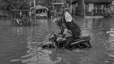

In the heart of Queensland, the city of Logan is grappling with a storm of a different kind as the Logan City Council rolls out new flood risk maps under a draft town plan mandated by the state government. These maps, designed to bolster preparedness against future flooding disasters in a region marked by two rivers and nearly 90 creeks, have instead unleashed a wave of anxiety among residents. Homeowners now face the daunting prospect of skyrocketing insurance premiums and dwindling property values due to reclassified risk zones. The personal toll is vividly captured in the plight of long-time resident Corrie Chabau, whose annual insurance bill already stands at a hefty $5,000 after a recent $1,200 hike. As fears mount that costs could climb even higher—or render properties uninsurable—the community is caught between the necessity of flood planning and the harsh financial realities it imposes, sparking widespread outcry and urgent calls for resolution.
Financial Strain on Homeowners
The updated flood risk mapping by the Logan City Council has categorized approximately 20,000 properties into low, moderate, and high-risk zones, reshaping the financial landscape for many residents. For individuals like Corrie Chabau, whose home now falls into a heightened risk category, the implications are nothing short of alarming. His insurance premium, already burdened by a recent $1,200 increase to $5,000 annually, looms as a potential precursor to even steeper costs. Reports from other locals paint an equally grim picture, with some receiving quotes for premiums as exorbitant as $30,000. This financial pressure is pushing many to the edge, with the specter of becoming uninsurable haunting homeowners who may soon find themselves forced to forgo coverage altogether if costs continue to spiral out of reach, threatening their economic stability in a region already vulnerable to natural disasters.
Beyond the immediate sting of rising premiums, the broader impact on household budgets and long-term financial planning cannot be ignored. Many residents, already stretched thin by the cost of living, are now reevaluating their ability to maintain homeownership under such burdensome conditions. The fear of uninsurability adds another layer of dread, as going without insurance in a flood-prone area like Logan could mean catastrophic losses in the event of a disaster. Community discussions reveal a growing sense of desperation, with homeowners contemplating drastic measures such as selling properties at a loss or dipping into savings to cover premiums. This situation underscores a critical disconnect between the intent of flood risk planning and the unintended economic fallout on individuals, leaving many to wonder how they can safeguard their homes without sacrificing their financial security in the process.
Challenges to Map Accuracy
A significant source of tension surrounding the new flood risk maps lies in the perceived discrepancies between the council’s assessments and the lived realities of Logan residents. Corrie Chabau, for instance, strongly disputes the classification of his property as high-risk, asserting that it only experiences minor stormwater runoff rather than the river flooding suggested by the mapping. Even during extreme weather events like Cyclone Debbie, which brought torrential rain to the area, his home remained largely unaffected by the type of flooding the maps warn against. This sentiment resonates across the community, where many feel that the designations exaggerate the actual threats, leading to unnecessary financial penalties through inflated insurance costs that do not align with their on-the-ground experiences of flood risk in the region.
This disconnect has bred a deep sense of frustration and mistrust among homeowners, who question the methodology behind the council’s risk evaluations. Numerous residents argue that the maps fail to account for localized nuances, such as effective drainage systems or historical flood patterns specific to their neighborhoods. Community forums have become platforms for voicing these concerns, with many calling for a reassessment of the data used to categorize properties. The prevailing belief is that inaccurate mapping not only burdens homeowners with unjust costs but also undermines confidence in public initiatives meant to protect them. As debates over the validity of these designations intensify, the gap between official policy and resident perception continues to widen, fueling demands for transparency and revised approaches to flood risk assessment.
Housing Market Implications
The flood risk labels attached to Logan properties are casting a long shadow over the local housing market, with homeowners fearing a steep decline in property values. Corrie Chabau voices a common concern that his home could become virtually “worth nothing” as potential buyers shy away from purchasing in areas flagged as high-risk. This apprehension is widespread, as the stigma of flood designations threatens to deter even well-informed buyers who might otherwise see value in the community. The result is a growing anxiety that properties, once considered stable investments, could transform into financial liabilities, trapping owners in homes they cannot sell without incurring significant losses in a market increasingly wary of flood-related risks.
Compounding this issue is the likelihood that the negative perception created by the maps will persist, even if future revisions adjust risk categories. Real estate experts note that once a property is associated with high flood risk, the label often lingers in the minds of buyers and insurers alike, diminishing marketability over the long term. For many in Logan, this means facing a dual hit: not only are current homeowners struggling with rising insurance costs, but they also risk being locked into devalued assets with little hope of recovery. The broader impact on neighborhood desirability and community growth adds another layer of concern, as declining property values could hinder local economic vitality. This complex web of market consequences highlights the far-reaching effects of flood mapping beyond immediate financial burdens.
Policy Goals Versus Resident Realities
Logan City Mayor Jon Raven stands by the flood risk mapping as an essential measure for disaster preparedness, particularly in a region with a history of severe flooding shaped by its extensive network of rivers and creeks. The draft town plan, mandated by the Queensland government, aims to enhance safety by identifying vulnerable areas and guiding future urban planning to mitigate flood impacts. Mayor Raven has emphasized that the council holds no sway over insurance premiums, which are influenced by a range of factors beyond local policy control. This perspective underscores the intent behind the initiative: to protect the community through proactive measures that anticipate and address natural disaster risks before they strike, ensuring a more resilient future for Logan.
However, the community response paints a starkly different picture, with many residents feeling blindsided by the unintended consequences of this well-meaning policy. Homeowners argue that while the goal of flood preparedness is laudable, the immediate fallout—namely, soaring insurance costs based on the new risk zones—places an unfair burden on individuals. There is a pervasive belief that insurers will continue to raise premiums regardless of potential map revisions, locking residents into a cycle of financial strain. Community meetings have revealed raw emotions, with stories of elderly couples and struggling families fearing the loss of their livelihoods due to costs they cannot sustain. This clash between policy objectives and personal repercussions illustrates a critical challenge: balancing the broader good of disaster planning with the real-world impact on those it aims to protect.
National Context and Future Risks
The crisis unfolding in Logan mirrors a broader national struggle with flood risk and insurance affordability across Australia, amplifying the urgency of the issue. According to a recent Climate Valuation report, over half a million homes nationwide could become uninsurable for flood damage within the next five years, a projection that casts a sobering light on the scale of the problem. Areas near Logan have already been identified as “black zones,” where over 80% of properties face the risk of uninsurability, highlighting how widespread vulnerability to flooding intersects with economic challenges. This trend points to a growing crisis that extends far beyond local boundaries, affecting communities in flood-prone regions across the country with similar fears of financial ruin.
Addressing this escalating issue requires a coordinated approach that transcends local policy, involving insurers, government bodies, and community stakeholders. The situation in Logan serves as a microcosm of a national dilemma, where the need for flood risk management must be weighed against economic fairness to homeowners. As predictions of increased flood exposure loom, with one in five Australian homes potentially at risk in the coming years, innovative solutions are imperative. Options such as subsidized insurance programs or revised risk assessment models could offer relief, but they demand swift action and collaboration. The lessons from Logan underscore the importance of integrating resident input into policy frameworks to prevent protective measures from inadvertently harming the very communities they are designed to safeguard, setting a precedent for broader reform.
Navigating the Path Forward
Reflecting on the turmoil in Logan, it’s clear that the rollout of flood risk maps, while rooted in a commitment to safety, left a trail of economic hardship for many residents. The steep rise in insurance premiums and the looming threat of uninsurable properties weighed heavily on homeowners who felt caught off guard by the policy’s fallout. Disputes over the accuracy of risk designations further eroded trust, as personal experiences clashed with official assessments. Meanwhile, the shadow cast over property values and the housing market deepened the community’s sense of vulnerability, revealing the unintended consequences of planning initiatives.
Looking ahead, the path to resolution hinges on fostering dialogue among policymakers, insurers, and residents to address the financial burdens imposed by flood mapping. The public consultation process initiated by the council offers a starting point for refining the maps, but broader strategies are needed to ensure affordability of insurance. National trends point to an urgent need for systemic solutions, such as risk-sharing models or government-backed protections, to prevent similar crises elsewhere. Logan’s experience serves as a call to prioritize economic equity alongside disaster preparedness, ensuring future policies safeguard communities without sacrificing their financial well-being.